17 Sites of Meaning in Derbyshire – Monumental Footsteps and Phrases

Carved in Stone: A Walking Route of Reflection and Discovery

At the turn of the millennium, the parish of Middleton by Youlgreave in Derbyshire’s Peak District embarked on a unique project called “Sites of Meaning.” This initiative placed 17 inscribed boundary stones at each entrance to the parish, creating a blend of natural beauty, local history, and personal expression.

Stone has always been integral to this landscape. From the underlying limestone to the dry stone walls parceling fields, from ancient markers to bustling quarries, stone shapes both the land and livelihoods. Similarly, words define us as individuals, revealing our thoughts, feelings, and beliefs.

The Sites of Meaning project marries these elements – stone and word – to capture a moment in time. Each boundary stone bears an inscription chosen by parish members, offering glimpses into their collective identity and individual perspectives at the dawn of a new era.

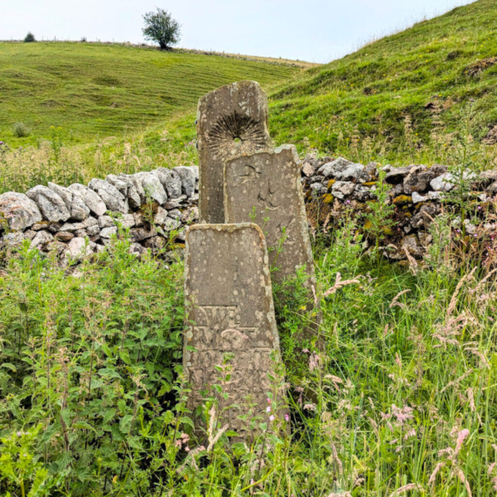
This concept draws inspiration from the rich history of text-inscribed stones in the region. From prehistoric rock art at Gardom’s Edge to biblical references at Curbar Gap, from ancient earthworks at Arbor Low to the evocative gravestones dotting the landscape, the Peak District has long used stone as a canvas for human expression.

The Sites of Meaning serve multiple purposes. They affirm the parish boundaries, welcoming visitors while defining the community’s space. More profoundly, they act as a public manifestation of private thoughts and feelings, preserving them for future generations.

Visitors are encouraged to explore these 17 sites, each offering a unique perspective on the parish and its people. As you journey from stone to stone, you’ll not only enjoy a delightful day out in the beautiful Peak District but also engage with the hopes, dreams, and reflections of a community at a pivotal moment in history.

My Adventure to Uncover Middleton's Hidden Gems

Discovering the Sites of Meaning stones became an irresistible adventure for me, combining my love for hiking with a fascination for local history and culture. The idea of following a self-created route using OS Maps to uncover these hidden gems appealed to my sense of exploration and planning.

Each stone represented a unique piece of the community’s story, waiting to be discovered amidst the breathtaking Derbyshire Peak landscape. The prospect of deciphering the inscriptions and connecting with the thoughts and feelings of Middleton’s residents at the turn of the millennium intrigued me.

Moreover, this walking route offered a perfect excuse to immerse myself in the countryside’s natural beauty. From rolling hills to drystone walls, from babbling brooks to ancient woodlands, every step promised a feast for the senses.

The challenge of navigating between the stones added an element of adventure, while the physical activity of the walk invigorated both body and mind. Ultimately, this journey wasn’t just about finding stones; it was about connecting with the land, its people, and their shared history in a deeply personal way.

Using the OS Maps App I created a route named “Sites of Meaning – from 0 to 11 – Middleton-by-Youlgreave” and saved this for anyone to use. Just download the OS Maps App for Android or Apple and you can find the route. From the “Routes” menu option search for SK 1954 6319 then disable the “recommended only” option and filter on Hiking, Easy, Less than 8 miles. 

When using the OS Maps App the route marker has an arrow which will point in the direction you face the phone and will keep you on the right path. Downloading the map and route is essential when heading out of mobile signal reach.

To subscribe to be able to save offline maps and routes just follow this link to the official OS Maps website  OS Maps Website. You do not need to subscribe to use the app to view maps or routes but when there is no signal you will not be able to navigate the route using the app. 

My Adventure to Uncover Middleton's Hidden Gems

Village Stone - Sites of Meaning Marker 0

a slab of stone with an enscription on it

Getting there:  Head to the centre of the village (Middleton DE45 1LS)  where you will hopefully find free roadside parking. There was plenty of space when I did my travels. The Village Stone can be found in the nature garden next to the playground.

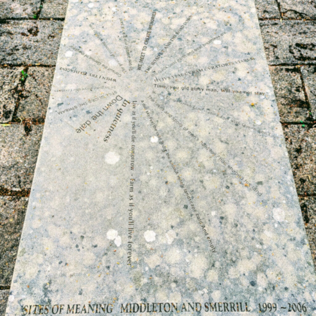
Background Info: The Village Stone was an unplanned addition to Sites of Meaning and serves as the project’s centrepiece. Located in Middleton’s square, this eighteenth stone functions as a compass for the entire initiative. Its design features seventeen lines of text radiating from the centre, each roughly aligned with its corresponding boundary stone’s location. The stone’s layout resembles a viewfinder, with each line’s first words pointing towards its boundary counterpart and the spiral motif symbolizes the project’s growth and development.

The inscription reads:
– In quietness – Down the dale – Still guides the stream – In bygone days the farmers – When I try to imagine – Consult the genius of the place – The peace of running water to you – To see a world in a grain of sand – We meet to create memories – The road up and the road down – Left quick past earth and beast breathless ere – HVIVS VIAE CVRAM CVRATORES VIARVM – Time, you old gipsy man, will you not stay – Bright under green limestone edges with Queen Ann lace – The rakes and spoils of man’s hard toil has shaped his land – A dull sky, feel the cold, touch the snow, a lonely landscape, and empty – Live as if you’ll die tomorrow – farm as if you will live forever.

Roughwood Seat - Sites of Meaning Marker 1

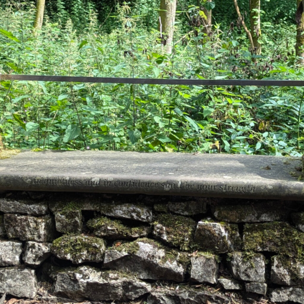
a stone slab seat embedded into a stone wall

Getting there: From the Village Stone take the Weadow Lane north out of the village centre. Follow the road until you see the Roughwood Seat on your right hand side embedded in the stone wall.

Background Info: Take a well earned rest on the stone seat embedded into the wall along the road from Middleton to Youlgrave. John Youatt the proposer for this stone researched the local Bateman family after moving to the village. When his stepmother requested quotes for needlework, he was drawn to Eugenie Bateman’s words: “In quietness and confidence shall be your strength.” This quote resonated with John for its personal significance and connection to Middleton’s famous family. He felt it perfect for the Sites of Meaning project, especially for a site atop a steep footpath where Emma Youatt (John’s daughter) had secured public access. The quote’s location by a resting seat added relevance. John later learned Eugenie had borrowed the line from the Bible, enriching its meaning with historical and spiritual connections.

The inscription reads:
In quietness and in confidence shall be your strength – Isaiah 30:15

Roughwood Kerbs - Sites of Meaning Marker 2

Getting there: The Roughwood Kerbs are just back up the hill slightly. I am sticking to the order the stones are numbered for this marker as it is so close to number 1.

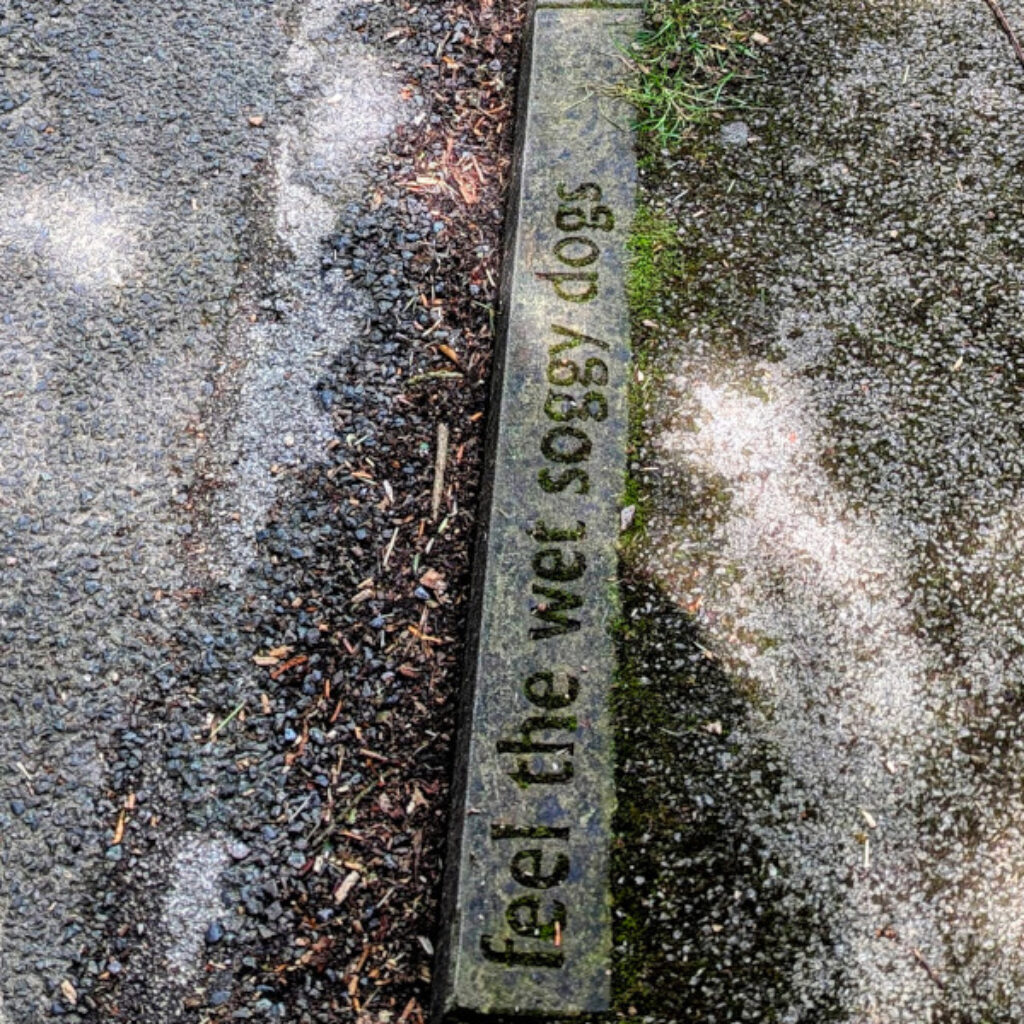
Background Info: The Other Stones – Other Meanings collaboration brought together Middleton and Smerrill adults with Youlgrave Primary School children, integrating local learning with community engagement. Working alongside community members, a poetry writer, and an archaeologist, students explored their environment through the theme of “stones.” This approach helped children grasp the significance of local artefacts, both past and present. The resulting sculptures and inscriptions are intended to be enjoyed by future generations, creating a lasting legacy of community and educational partnership. This initiative exemplifies hands-on, community-based learning that connects children with their local heritage.

The inscription reads:
Down the dale feel the wet soggy dogs which have just come out of the river. He’s beautiful, golden, white fur, wild, free, ready to come and go as he pleases. 

Bradford Bridge - Sites of Meaning Marker 3

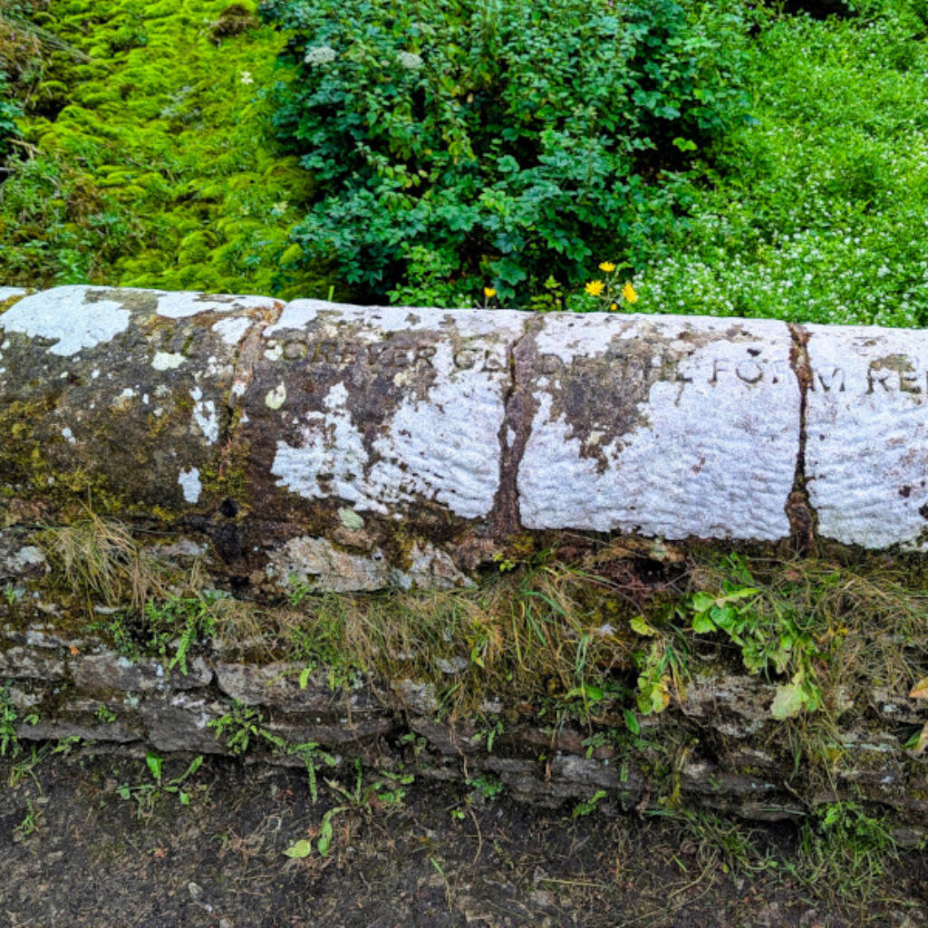
a old stone bridge covered in moss and lychen

Getting there: Back down just past the Roughwood Seat is a finger post pointing the way down a lovely wooded single track that zig zags its way to Bradford Bridge. There is another path that could be taken by mistake, just past the ruined building (an old flour mill) the path splits. Take the right path almost back on yourself which leads down to the bridge. 

Background Info: The old bridge bears the mark of the Sites of Meaning handiwork much to some folks’ chagrin at first. It seemed sacrilege to some people to make changes to something so old and indeed the new carving did stand out at first when etched nearly 20 years ago. But nature, ever the artist, had other plans. Lichen has softened the outlines over time and crept into the text blending new with old. Now? The words meld seamlessly with ancient stone as if they’d always been there.

Inscription reads:
Still glides the stream, and shall forever glide; The form remains, the function never dies. – William Wordsworth

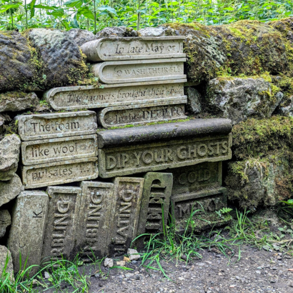
Sheep Dip - Sites of Meaning Marker 4

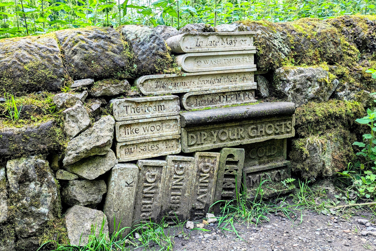
Getting there: From the inscription on Bradford Bridge continue across the bridge, turn right and follow the river along the valley. There are some interesting pools and evidence of man made structures to control the water. These are remains of an old mill now absent from the landscape. Continue on until a bend in the track. Just crossing back over the river the next set of carvings should be seen embedded in the stone wall on the left.

Background Info: Due to the World Cup, England – Argentina World Cup match in 2002, the local kids were somewhat distracted but still managed to find some appropriate words for this markerstone, my personal favorite set of carvings. An old map shows the pool behind this marker to have been a mill pond but also had other uses. Sheepwashing pens and dip, Bradford Dale, Middleton and Smerrill describe this as a sheep washing complex.

The inscription reads:
In late May or June – The farmers brought their sheep – To wash their fleeces – In this deep pool – Burbling, bumbling, bleating – The waters bleat like a flock of sheep it dipped – Dip your ghosts into this hard, cold merky place – Hear their bleat in the water’s rush to escape – The foam like wool pulsates – Damp leaves nothing behind but the trees’ readiness

Clapper Bridge - Sites of Meaning Marker 6

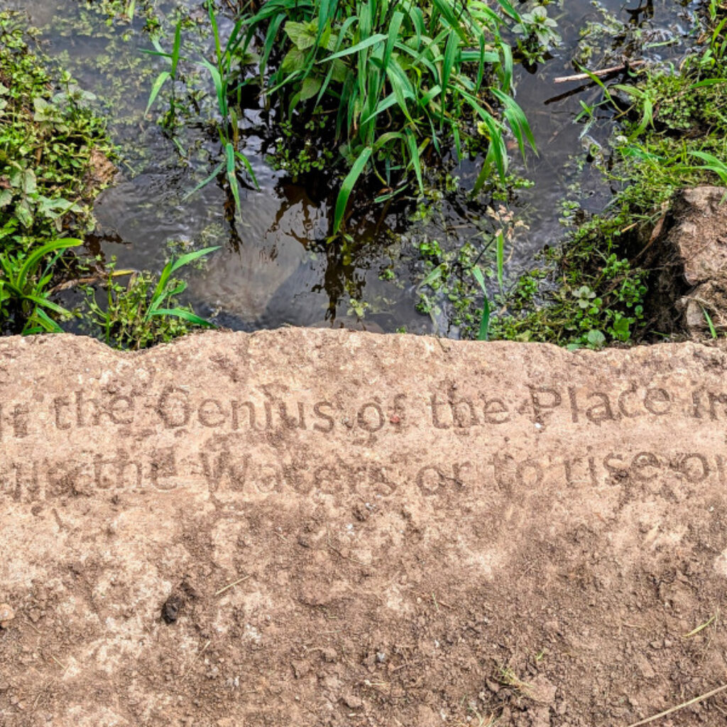
an image of a slab of rock with an enscription on it reading Consult the Genius of the Place in all; That tells the Waters or to rise or fall

Getting there: It is worth noting that marker 5 is included later along the route and also that the OS map footpath does not match the current footpath and is shown on the wrong side of the river. From the Sheep Dip marker stone continue in the same direction heading southwest for just a few meters until a path can be taken on the left-hand side heading southeast. Take this path and follow it to a small wooden bridge. Cross the bridge and follow the path to a set of metal stairs. Climb up the stairs and turn right heading east. Not far along where the path opened out is the Clapper Bridge.

Background Info: Archaeologists initially opposed marking Rowlow Dale’s damaged clapper bridge. During restoration, an inscribed slab was added. Proposer Robin Allan hoped the words would inspire fresh perspectives on Middleton’s beauty. This project blended historical preservation with poetic sentiment, transforming a decaying landmark into a thought-provoking monument celebrating local heritage and nature.

The inscription reads:
Consult the Genius of the Place in all; That tells the Waters or to rise or fall – Alexander Pope

Rowlow Brook - Sites of Meaning Marker 7

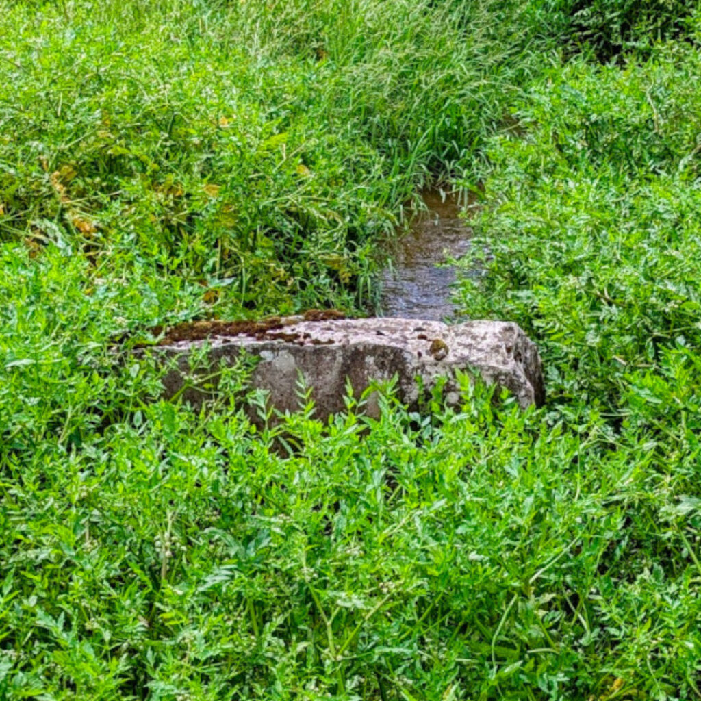
Getting there: From the clapper bridge continue slightly left and up the grassy slope. At the top of the slope head right along the path heading south. Keep going straight across the fields, through the stiles, until you come out on a narrow road. Turn left and walk just a few meters until you see the stone wall on the right hand side. A stream now crosses underneath the road but looking over the stone wall the Rowlow Brook marker should be visible in the water. In July it was mostly hidden with plant life from the stream as you can see from the photo.

Background Info: There is not much information on the history of this stone other than saying that it marks the easternmost boundary of the parish as does Rowlow Brook. It was certainly peaceful listening to the running water. Hard to believe that the fields just crossed had once been a rifle range. 

The inscription reads:
The peace of running water to you

Over Rusden - Sites of Meaning Marker 5

Getting there: From the stone wall overlooking the marker in Rowlow Brook, head back to the path leading from the Clapper Bridge but take the path on the opposite side of the road. Heading southwest follow the path until crossing a small low wooden fence. Head slightly right up the grassy slope to end up near a large Ash tree. Here you should find the Over Rusden marker. I missed this on my first attempt because I followed the path along the field boundary. I was too far to the right.

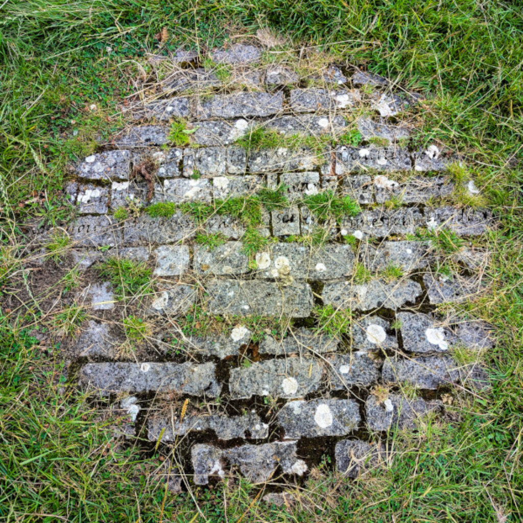
Background Info: Lines from Auden’s “In Praise of Limestone” were intended for Bradford Dale’s serene landscape. After permission to carve existing stone was denied, the Sites of Meaning team and sculptor Peter Maris chose a spot near Smerrill Grange. They created a circular arrangement of individual stones, emphasizing each word and the poem as a whole. This installation, overlooking the river and limestone face, harmoniously blends Auden’s poetry with the unique natural setting.

The inscription reads:
But when I try to imagine a faultless love / Or the life to come, what I hear is the murmur / Of underground streams, what I see is a limestone landscape – WH Auden

Smerrill - Sites of Meaning Marker 8

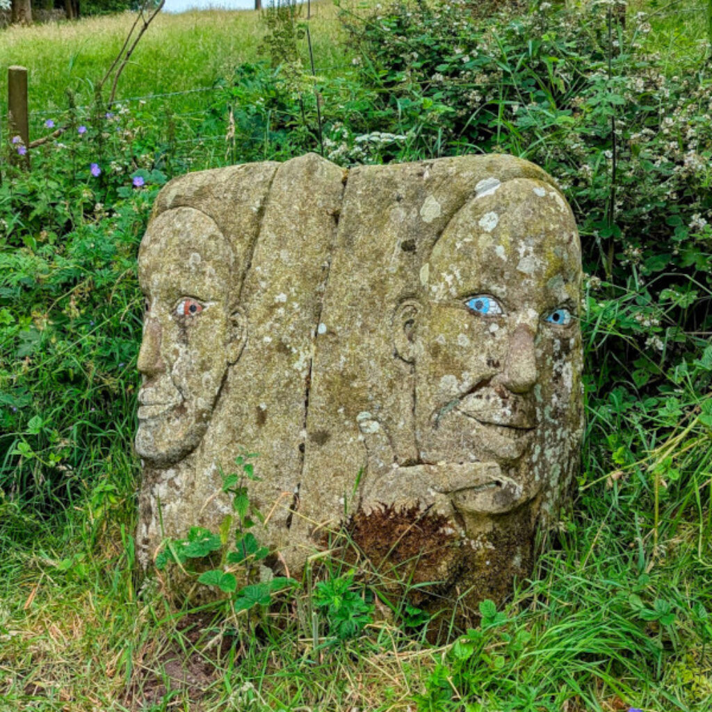
a carved rock with two faces with painted eyes

Getting there: From the stone circle follow the boundary of the field southwest. You should pop out onto Weaddow Lane. Head left but keep a close eye open for a footpath fingerpost slightly hidden and a wooden style on the left side of the road. Head south crossing the field and ending with the farm on your left. Go through the gate onto the lane and head left up the hill. On a left hand bend in the road, the Smerrill stone can be easily found looking bright eyed. 

Background Info: The sculptor Amanda for her design drew inspiration from the pointing hands on Derbyshire’s guide stoops. The Smerrill stone, carved during Amanda’s 2002 Sculpture Residency, is the only Site 8 stone to face vandalism. Shortly after installation, its noses were chiselled off and its eyes gouged. The motives remain unclear: Was its size imposing? Did its figurative nature make it too sculptural? Or was it targeted during the 2002 Countryside Alliance rally as a symbol of changing rural values? Despite these questions, the stone has since been repaired and continues to stand intact, a resilient marker of art and landscape.

The inscription reads:
To see a world in a grain of sand and a heaven in a wild flower, hold infinity in the palm of your hand, and eternity in an hour. – William Blake

Longdale - Sites of Meaning Marker 9

Getting there: From the Smerrill stone head back down the way you came. Follow the road downhill to a very sharp right bend. On the left in the corner is a footpath leading up between two stone walls. Follow this path heading uphill and keep going until there is a steep valley in front. Head slightly left down the path into the valley to the corner where the stone walls close in to find the Longdale marker stone surrounded by stone walls. I could not get the OS Maps route to put a waypoint in the actual location of the marker stone so on the OS Map route it is just as near as I could get it.

Background Info: Alan Burgess the proposer for this stone spent November 1993 trekking in Nepal, an experience he considers unforgettable. He was captivated by the incomprehensible scale and beauty of the mountains but equally moved by the people he encountered. Despite their modest possessions, they welcomed him with rich hospitality. On his last day, in a small tea house in Lukla, he noticed a quotation that encapsulated his month in the Himalayas. The combination of meeting wonderful people and seeing their magnificent mountains left an indelible impression on Burgess, creating memories he vows never to forget.

The inscription reads:
We meet to create memories and depart to cherish them.

Balderstone - Sites of Meaning Marker 10

a stone tablet with some text carved in to it

Getting there: From the Longdale stone head back up the hill northwest to follow the bridleway or stay low in the bottom of the valley. The paths meet further up the valley by a wooded area. Keep going with the trees on your right. Go through a metal gate into a beautiful grassy glade. Follow the glade until it starts to widen out. Keep left and head for the left corner. There is a gap in the wall to allow entry onto a path heading northwest with stone walls on either side. Follow this path to a big sycamore tree. The Balderstone is embedded in the stone wall opposite the tree. 

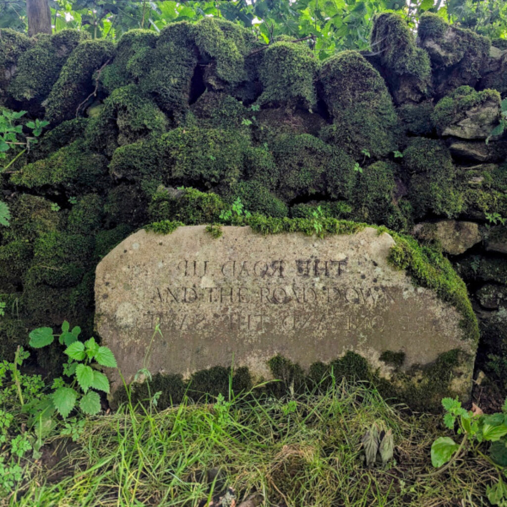
Background Info: The sculptor Jamie Vans was immediately drawn to the green lane where his piece stands, appreciating its location away from cars in a beautiful valley. He found the Heraclitus quotation appealing when conceiving how to arrange it. He believed it would inspire pleasant and reflective thoughts. The artist was pleased to use Hoptonwood stone, which is relatively local to the village and complements the walls in Longdale. He saw this choice of material as an important aspect of integrating his work into the local landscape.

The inscription reads:
The road up and the road down are one and the same – Heraclitusoposit

Friden Bends - Sites of Meaning Marker 11

Getting there: From the Balderstone continue on the path towards the road.  There is no footpath along the road so if it is busy with cars you leave this stone out and turn right across the end of the field in a northeast direction and meet the road higher up where it is a bit wider. To visit the Friden Bends stone head left along a narrow path then right up onto the road. Turn right head down the road, round a right-hand bend, then up towards a left-hand bend. At the start of the left-hand bend and between two trees is the stone. 

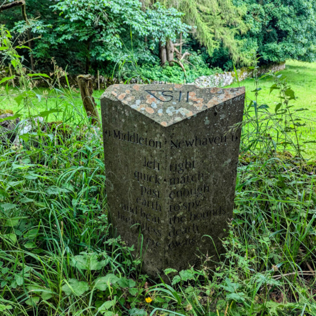
Background Info: David Fine approached his milestone project with a poet’s sensibility, viewing it as a formal structure and information about the environment. He aimed to create a poem readable in three ways: entering the parish, leaving it, and as a complete stone. Fine found the task unrelentingly challenging, as it required perfection without drafts or later corrections. Fine ultimately described his creation as “literally a literal milestone,” encapsulating both its physical function and artistic significance.

The inscription reads:
left – right, quick – march, past – enough, earth – to spy, and beat – the bounds, breathless – death, ere – owns – David Fine

Getting back to Middleton

Getting Back: Continue on the road up the hill until you reach a finger post and a small wooden gate on the right-hand side. Go through the gate heading northeast cutting diagonally across to the bottom left of the field. Go through the small gate, across the track and into the next field via another small gate. Keep in the same direction heading diagonally across the next field to about 1/4 of the way along from the left on the stone wall ahead. In the next field keep the same direction to about the middle of the stone wall ahead. Keeping the same direction head to about 3/4 of away along the wall ahead and then last field head for the bottom right corner. Kenslow farm should be on your left and a track running from the farm eastwards. Follow the farm track east until Little Rockery Farm. Turn left heading up the road, Whitfield Lane. Continue to a T junction and turn right to head back down to Middleton Centre.

a horse chewing some grass in black and white

Sites of Meaning Markers 12 to 17

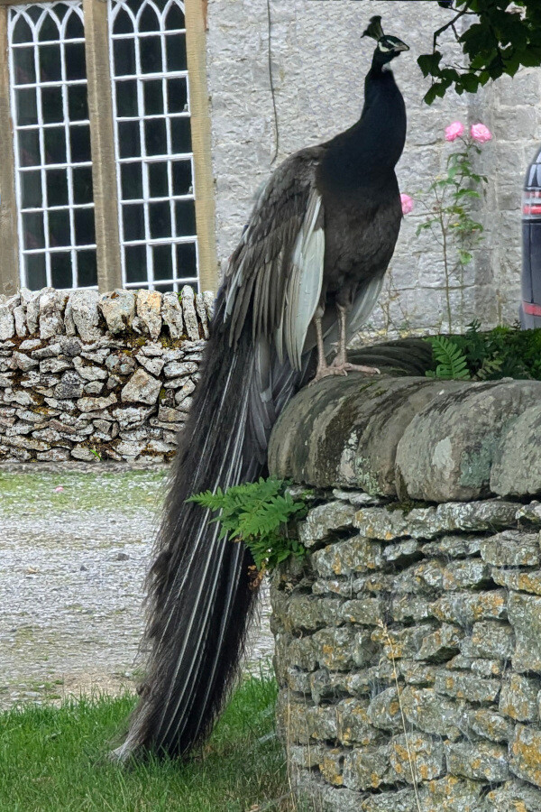
a black shouldered peacock that has a blue black neck and grey plummage. Rare bird

A Black Shouldred Peacock in Middleton

If you have some spare time left then the other markers are achievable on the same day. I cheated and drove to 5 out of the 6 I had left as I only had a limited time free.

Markers 13 to 17 are pretty quick and easy to do by car or cycle and on a quiet day you can park almost next to each one. I have mapped all the Sites of Meaning marker stones into Google Maps so you can get directions if driving or cycling is an option. 

Roman Road Sites of Meaning -Marker 12

Marker 12: Roman Road – Navigation and Insights

Reaching Marker 12, known as the Roman Road, presents a bit more of a challenge compared to other markers on the route. Due to time constraints, I was unable to complete this part of the journey, but here are some detailed options and insights for those who wish to visit.

Route Options:

  1. Extending from Marker 11 (Friben Bends):

    • Continue from Marker 11 to Marker 12 before heading back to Middleton. This extension will add approximately 50 minutes of walking and an additional 2 miles to your route.
    • Note: The final part of this route involves walking along narrow lanes. While these roads are not generally busy, caution is advised.
  2. Parking at the Jug & Glass Inn:

    • With prior permission, you could potentially (I don’t know) park at the Jug & Glass Inn, provided you patronize their establishment. Marker 12 is a 20-minute walk from the pub and of course 20 minutes back again.
    • This option allows for a convenient break, and the inn offers a good opportunity to enjoy some local food and drink.
  3. Using Google Maps for Directions:

    • Google Maps can guide you to Marker 12 by car!!! However, be aware that the route involves narrow and potentially muddy tracks. I do not think this track is suitable for cars.
    • The path is marked with green circles on OS Maps, indicating unclear access rights. Therefore, I recommend sticking to foot or mountain bike travel for this segment.

Historical Context:

Marker 12 bears an inscription: “Hvivs viae cvram cvratores viarvm non svscepervnt.” Online translations suggest this means something along the lines of,  “The road supervisors did not undertake the care of the roads.” This inscription hints at historical neglect or maintenance issues, perhaps referring specifically to Green Lane judging by looking at it from Google Satellite view.

Future Updates:

Stay tuned for an upcoming post where I will outline a new route that includes Markers 12 to 17. This journey will potentially start at Parsley Hay, which offers parking facilities and will follow the Midshires Way.

For those who enjoy exploring historical routes and markers, Marker 12 promises a unique experience despite the extra effort required to reach it. Meanwhile, checkout our other Derbyshire walks Happy walking!


Camping Secrets - Outdoor Guides and Reviews
Logo